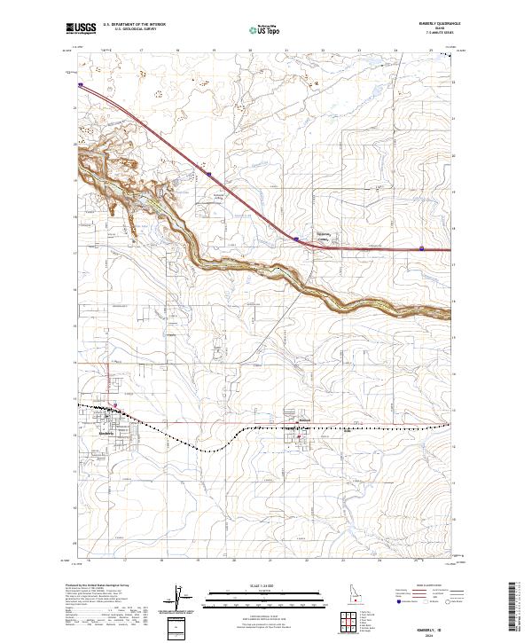
2024 Map of Kimberly
USGS Topo · Published 2024About this map
The Snake River carves a deep path across this part of the Snake River Plain, marking the boundary between Jerome and Twin Falls counties. The dramatic geology of Box Canyon and the presence of Echo Lake and Vineyard Lake north of the river contrast with the heavily engineered agricultural landscape to the south. This area is defined by an intricate network of irrigation, featuring the Twin Falls Main Canal and various laterals like Lateral C-52 and Lateral C-33, which support the high-desert farming economy. The settlements of Kimberly and Hansen are centered on a grid of residential streets such as Center St E and Adams St, while smaller rural nodes like Tipperary Corner and Bills sit at key road junctions. Aviation history is noted at Fairbanks Airfield, positioned near the highway northwest of the canyon rim.
Find a feature on this map
56 named features on this map. Tap any name to fly to it.
Don’t see what you’re looking for? This feature index may not catch every label — zoom into the map to look around manually.
Map Details
Editions of this 2024 Kimberly Map
This is the sole edition of this map. No revisions or reprints were ever made.
Other maps of this area

1955 · Twin Falls
USGS Topo · 1:250,000

1958 · Twin Falls
USGS Topo · 1:250,000

1964 · Kimberly
USGS Topo · 1:24,000

1964 · Falls City
USGS Topo · 1:24,000

1964 · Twin Falls
USGS Topo · 1:24,000

1964 · Eden
USGS Topo · 1:24,000

1964 · Perrine
USGS Topo · 1:24,000

1964 · Hunt
USGS Topo · 1:24,000

1965 · Stricker Butte
USGS Topo · 1:24,000

1965 · Hub Butte
USGS Topo · 1:24,000