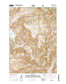
2014 Map of Kimberly
USGS Topo · Published 2014About this map
The settlement of Kimberly sits at the confluence where the North Fork John Day River joins the main John Day River, marking a vital point of transit in this high-desert landscape. The terrain is defined by dramatic elevation changes, from the alluvial plains of Haystack Valley to the heights of Tamarack Mtn and Little Tamarack Mtn. The northern reaches are part of the Umatilla National Forest, which includes the steep drainages of West Bologna Canyon and East Bologna Canyon.
Find a feature on this map
34 named features on this map. Tap any name to fly to it.
Don’t see what you’re looking for? This feature index may not catch every label — zoom into the map to look around manually.
Map Details
Editions of this 2014 Kimberly Map
This is the sole edition of this map. No revisions or reprints were ever made.
Other maps of this area

1953 · Richmond
USGS Topo · 1:62,500

1953 · Kimberly
USGS Topo · 1:62,500

1953 · Picture
USGS Topo · 1:62,500

1953 · Spray
USGS Topo · 1:62,500

1955 · Canyon City
USGS Topo · 1:250,000

1959 · Canyon City
USGS Topo · 1:250,000

1980 · Monument
USGS Topo · 1:100,000
1990 · Miller Flat
USGS Topo · 1:24,000
1990 · Bologna Basin
USGS Topo · 1:24,000
1990 · Turner Mountain
USGS Topo · 1:24,000