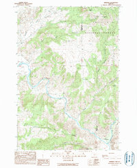
1990 Map of Kimberly
USGS Topo · Published 1990About this map
The confluence of the John Day River and the North Fork John Day River anchors this landscape in eastern Oregon, showing the terrain as it was recorded during field checks in the late 1980s. The small settlement of Kimberly sits near this junction, serving as a rare point of human habitation in a region dominated by sharp relief and canyon systems. To the north, the boundary of the Umatilla National Forest encompasses high points like Tamarack Mtn and Little Tamarack Spring. The map documents a rugged drainage network characterized by deep incisions like Bologna Canyon and its western and eastern branches. Land use is largely defined by the geography, with the 32 Ranch and the distinctive China Hat Peak standing as landmarks in a territory divided by the Wheeler and Grant county line.
Find a feature on this map
23 named features on this map. Tap any name to fly to it.
Don’t see what you’re looking for? This feature index may not catch every label — zoom into the map to look around manually.
Map Details
Editions of this 1990 Kimberly Map
This is the sole edition of this map. No revisions or reprints were ever made.
Other maps of this area

1953 · Richmond
USGS Topo · 1:62,500

1953 · Kimberly
USGS Topo · 1:62,500

1953 · Picture
USGS Topo · 1:62,500

1953 · Spray
USGS Topo · 1:62,500

1955 · Canyon City
USGS Topo · 1:250,000

1959 · Canyon City
USGS Topo · 1:250,000

1980 · Monument
USGS Topo · 1:100,000
1990 · Miller Flat
USGS Topo · 1:24,000
1990 · Bologna Basin
USGS Topo · 1:24,000
1990 · Turner Mountain
USGS Topo · 1:24,000