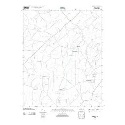
2010 Map of Kimesville
USGS Topo · Published 2010About this map
Kimesville and the surrounding rural landscape of Alamance and Guilford Counties are defined by the intricate drainage of the North Prong Stinking Quarter Creek and its southern counterpart. In this 2010 topographic survey, the area’s agricultural and residential character is evident through an extensive network of named roads, including Holts Store Rd and Kimesville Rd. Water management plays a central role in the local geography, with significant impoundments such as Kimesville Lake, Richardson Pond, and Timber Ridge Lake altering the natural flow of the creeks. The presence of Causey Airport and the Staley Mill Dam reflects the intersection of modern transport and earlier industrial foundations. Smaller watercourses like Chocolate Creek and Poppaw Creek lace through the terrain, connecting the scattered homesteads and local roads that have served this community for generations.
Find a feature on this map
77 named features on this map. Tap any name to fly to it.
Don’t see what you’re looking for? This feature index may not catch every label — zoom into the map to look around manually.
Map Details
Editions of this 2010 Kimesville Map
This is the sole edition of this map. No revisions or reprints were ever made.
Other maps of this area

1952 · Mc Leansville
USGS Topo · 1:24,000

1953 · Raleigh
USGS Topo · 1:250,000

1953 · Greensboro
USGS Topo · 1:250,000

1954 · Greensboro
USGS Topo · 1:250,000

1954 · Raleigh
USGS Topo · 1:250,000

1962 · Greensboro
USGS Topo · 1:250,000

1966 · Greensboro
USGS Topo · 1:250,000

1969 · Burlington
USGS Topo · 1:24,000

1970 · Gibsonville
USGS Topo · 1:24,000

1970 · Kimesville
USGS Topo · 1:24,000