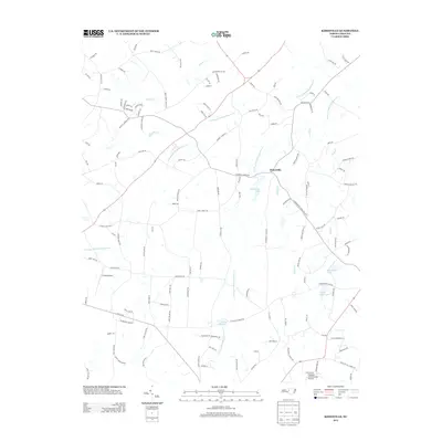
2013 Map of Kimesville
USGS Topo · Published 2013About this map
Kimesville sits as the central settlement in this North Carolina landscape, where the geography is defined by the branching tributaries of the Stinking Quarter Creek system. The area's agricultural and rural character is evidenced by the network of small private airfields, including Causey Airport and Hinshaw (Greenacres) Airport, which support local aviation and land management. The water drainage pattern shows a high concentration of small reservoirs and ponds, such as Kimesville Lake, Staley Mill Lake, and Timber Ridge Lake, likely serving as significant local water sources or recreational points for the surrounding farms.
Find a feature on this map
130 named features on this map. Tap any name to fly to it.
Don’t see what you’re looking for? This feature index may not catch every label — zoom into the map to look around manually.
Map Details
Editions of this 2013 Kimesville Map
This is the sole edition of this map. No revisions or reprints were ever made.
Other maps of this area

1952 · Mc Leansville
USGS Topo · 1:24,000

1953 · Raleigh
USGS Topo · 1:250,000

1953 · Greensboro
USGS Topo · 1:250,000

1954 · Greensboro
USGS Topo · 1:250,000

1954 · Raleigh
USGS Topo · 1:250,000

1962 · Greensboro
USGS Topo · 1:250,000

1966 · Greensboro
USGS Topo · 1:250,000

1969 · Burlington
USGS Topo · 1:24,000

1970 · Gibsonville
USGS Topo · 1:24,000

1970 · Kimesville
USGS Topo · 1:24,000