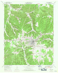
1951 Map of Kimmins
USGS Topo · Published 1971About this map
The town of Hohenwald serves as the central hub of this mid-century landscape on the border of Hickman and Lewis counties. The map reveals a community organized around topographic drainage, where numerous named hollows like Stillhouse Hollow and Silvermine Hollow hint at the local activities and industries of previous generations. A significant concentration of family and community burial grounds, including the Swiss Cem, Grassy Valley Cem, and O'Guin Cem, provides an invaluable resource for tracing regional genealogy and settlement patterns.
Find a feature on this map
78 named features on this map. Tap any name to fly to it.
Don’t see what you’re looking for? This feature index may not catch every label — zoom into the map to look around manually.
Map Details
Editions of this 1951 Kimmins Map
3 editions found
Other maps of this area

1901 · Colombia
USGS Topo · 1:125,000

1905 · Waynesboro
USGS Topo · 1:125,000

1936 · Riverside
USGS Topo · 1:24,000

1936 · Graves Spring
USGS Topo · 1:24,000

1936 · Pleasantville
USGS Topo · 1:24,000

1936 · Beaverdam Springs
USGS Topo · 1:24,000

1936 · Henryville
USGS Topo · 1:24,000

1936 · Sunrise
USGS Topo · 1:24,000

1936 · Kimmins
USGS Topo · 1:24,000

1936 · Topsy
USGS Topo · 1:24,000