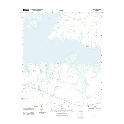
2012 Map of Kincaid
USGS Topo · Published 2012About this map
Grenada Lake dominates the northern landscape of this Mississippi territory, where the shoreline is punctuated by local landmarks like Carver Point and Cape Retreat. The topography is defined by the winding course of Hurricane Branch and several smaller tributaries like Gibbs Cr, which carve through the land south of the water. For genealogists, the map is remarkably dense with family-named burial sites, including Bob Quarters Cem, Dodson Cem, and Stephens Cem, indicating a deeply rooted rural community.
Find a feature on this map
60 named features on this map. Tap any name to fly to it.
Don’t see what you’re looking for? This feature index may not catch every label — zoom into the map to look around manually.
Map Details
Editions of this 2012 Kincaid Map
This is the sole edition of this map. No revisions or reprints were ever made.
Other maps of this area

1953 · West Point
USGS Topo · 1:250,000

1954 · Grenada
USGS Topo · 1:62,500

1954 · Duck Hill
USGS Topo · 1:62,500

1954 · McCarley
USGS Topo · 1:62,500

1955 · Coffeeville
USGS Topo · 1:62,500

1958 · West Point
USGS Topo · 1:250,000

1963 · West Point
USGS Topo · 1:250,000
1971 · Coffeeville
USGS Topo · 1:24,000
1983 · Tie Plant
USGS Topo · 1:24,000
1983 · Duck Hill
USGS Topo · 1:24,000