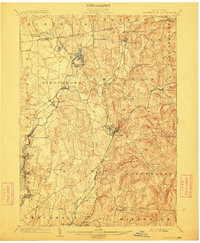
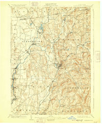
1903 Map of Kinderhook
USGS Topo · Published 1912About this map
Kinderhook Creek and its many tributaries define the landscape of Columbia County at the start of the 20th century, powering industrial hamlets like Stuyvesant Falls and Chittenden Falls. This era of the Hudson Valley was characterized by a dense network of early transportation, including the Albany and Hudson Electric Ry and the Boston and Albany R.R. (Hudson and Chatham Div.), which connected established manufacturing centers such as Valatie and Philmont. The map reveals the intricate placement of mill sites like White Mills and the social geography of the region through small, distinct settlements like Niverville, Malden Bridge, and Rayville. The concentration of rail lines and depot locations like Brainard Station illustrates a period of high connectivity for these rural and industrial communities before the automotive era reshaped the corridor.
Find a feature on this map
55 named features on this map. Tap any name to fly to it.
Don’t see what you’re looking for? This feature index may not catch every label — zoom into the map to look around manually.
Map Details
Editions of this 1903 Kinderhook Map
6 editions found

Other maps of this area

1885 · Sheffield
USGS Topo · 1:62,500

1888 · Sheffield
USGS Topo · 1:62,500

1888 · Berlin
USGS Topo · 1:62,500

1888 · Pittsfield
USGS Topo · 1:62,500

1890 · Pittsfield
USGS Topo · 1:62,500

1890 · Berlin
USGS Topo · 1:62,500

1891 · Sheffield
USGS Topo · 1:62,500

1893 · Troy
USGS Topo · 1:62,500

1893 · Coxsackie
USGS Topo · 1:62,500

1893 · Sheffield
USGS Topo · 1:62,500