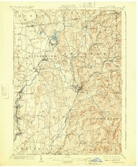
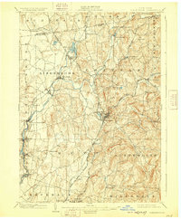
1903 Map of Kinderhook
USGS Topo · Published 1925About this map
The rail-and-river geography of northern Columbia County dominates this landscape at the dawn of the twentieth century, centered on the major railway hub at Chatham. This junction point serves as a convergence for the Boston and Albany R.R., the Rutland R.R., and the Harlem Division of the New York Central, illustrating the intensive network of transportation that fueled regional industry. Along the winding Kinderhook Creek, manufacturing centers like Valatie, Stuyvesant Falls, and Chittenden Falls utilized water power for local mills, while the Albany and Hudson Electric R.R. provided a modern transit link through Sunnyside and Niverville. The map also captures several distinct settlements such as Old Chatham and Spencertown, providing a clear record of the community structures and rural roads that connected these upland farming and milling districts before the era of modern highways.
Find a feature on this map
57 named features on this map. Tap any name to fly to it.
Don’t see what you’re looking for? This feature index may not catch every label — zoom into the map to look around manually.
Map Details
Editions of this 1903 Kinderhook Map
6 editions found

Other maps of this area

1885 · Sheffield
USGS Topo · 1:62,500

1888 · Sheffield
USGS Topo · 1:62,500

1888 · Berlin
USGS Topo · 1:62,500

1888 · Pittsfield
USGS Topo · 1:62,500

1890 · Pittsfield
USGS Topo · 1:62,500

1890 · Berlin
USGS Topo · 1:62,500

1891 · Sheffield
USGS Topo · 1:62,500

1893 · Troy
USGS Topo · 1:62,500

1893 · Coxsackie
USGS Topo · 1:62,500

1893 · Sheffield
USGS Topo · 1:62,500