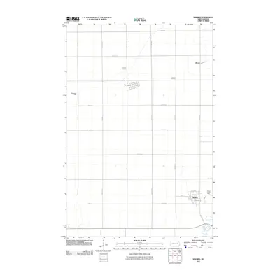
2011 Map of Kindred
USGS Topo · Published 2011About this map
Kindred and Davenport anchor this survey of the Red River Valley’s western edge, where a rigid grid of agricultural roads defines the prairie landscape. The Sheyenne River meanders through the southeastern corner, providing a stark contrast to the straight lines of 53rd St SE and 160th Ave SE. This survey details the local aviation history of the region through Schroeder Field and Hamry Landing Field, which serve the surrounding farmsteads. Genealogical interest centers on the Davenport Cemetery north of its namesake town and the German Cemetery situated along 164th Ave SE. The settlement of Warren appears in the northeast, connected to the larger transport network by Warren St. The map illustrates a rural North Dakota community defined by its precise section lines and its relationship to the river valley drainage.
Find a feature on this map
37 named features on this map. Tap any name to fly to it.
Don’t see what you’re looking for? This feature index may not catch every label — zoom into the map to look around manually.
Map Details
Editions of this 2011 Kindred Map
This is the sole edition of this map. No revisions or reprints were ever made.
Other maps of this area

1895 · Fargo
USGS Topo · 1:125,000

1895 · Casselton
USGS Topo · 1:125,000

1897 · Fargo
USGS Topo · 1:125,000

1897 · Casselton
USGS Topo · 1:125,000

1953 · Fargo
USGS Topo · 1:250,000

1956 · Fargo
USGS Topo · 1:250,000

1959 · Kindred
USGS Topo · 1:24,000

1959 · Leonard
USGS Topo · 1:24,000

1959 · South West Fargo
USGS Topo · 1:24,000
1959 · Walcott
USGS Topo · 1:24,000