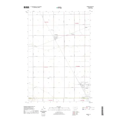
2020 Map of Kindred
USGS Topo · Published 2020About this map
Davenport and Kindred anchor this corner of the Red River Valley, where the grid of agricultural section lines is occasionally interrupted by the winding course of the Sheyenne River. The landscape is defined by its rural heritage, preserved through numerous local landmarks like Christiania Cem, Kindred Cem, and the Immanuel German Lutheran Cem. In the north, the small settlement of Warren sits near the tracks, while Davenport Cem serves the nearby community. Aviation interest is noted at Robert Odegaard Field just north of Kindred, reflecting the modern utility of these wide-open plains. The map meticulously records the transition from Cass Co to Richland Co along its southern edge, providing a precise look at the land divisions and township boundaries such as t137n r50w and t138n r51w that have organized this farming region since settlement.
Find a feature on this map
72 named features on this map. Tap any name to fly to it.
Don’t see what you’re looking for? This feature index may not catch every label — zoom into the map to look around manually.
Map Details
Editions of this 2020 Kindred Map
This is the sole edition of this map. No revisions or reprints were ever made.
Other maps of this area

1895 · Fargo
USGS Topo · 1:125,000

1895 · Casselton
USGS Topo · 1:125,000

1897 · Fargo
USGS Topo · 1:125,000

1897 · Casselton
USGS Topo · 1:125,000

1953 · Fargo
USGS Topo · 1:250,000

1956 · Fargo
USGS Topo · 1:250,000

1959 · Kindred
USGS Topo · 1:24,000

1959 · Leonard
USGS Topo · 1:24,000

1959 · South West Fargo
USGS Topo · 1:24,000
1959 · Walcott
USGS Topo · 1:24,000