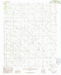
1986 Map of King Draw
USGS Topo · Published 1986About this map
The high desert settlement of Hyer anchors this mid-1980s landscape in Santa Fe County, where traditional land divisions meet modern infrastructure. The terrain is defined by the deep incisions of King Draw and Big Draw, which channel seasonal water across the high plains. A clear industrial presence is visible through the Gravel Pit located in the southeastern quadrant, alongside a remote Landing Strip that suggests the logistical needs of this arid ranching and utility corridor. The map highlights the intersection of the T12N and T11N township lines and the passage of a significant Trans Line utility route. This provisional edition preserves the specific configuration of rural dwellings and access trails before subsequent growth in the region, offering a precise look at the 1980s New Mexico backcountry.
Find a feature on this map
8 named features on this map. Tap any name to fly to it.
Don’t see what you’re looking for? This feature index may not catch every label — zoom into the map to look around manually.
Map Details
Editions of this 1986 King Draw Map
This is the sole edition of this map. No revisions or reprints were ever made.
Other maps of this area

1892 · San Pedro
USGS Topo · 1:125,000

1894 · Lamy
USGS Topo · 1:125,000

1954 · San Pedro
USGS Topo · 1:24,000

1954 · Edgewood
USGS Topo · 1:24,000

1954 · Santa Fe
USGS Topo · 1:250,000

1956 · Edgewood
USGS Topo · 1:62,500

1958 · Santa Fe
USGS Topo · 1:250,000

1958 · Albuquerque
USGS Topo · 1:250,000

1960 · Stanley
USGS Topo · 1:62,500

1961 · Madrid
USGS Topo · 1:62,500