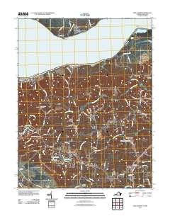
2011 Map of King George
USGS Topo · Published 2011About this map
Caledon State Park and the winding course of the Potomac River anchor this landscape, where the northern neck of Virginia transitions from wooded riverbanks to established rural centers. The settlement at King George acts as a focal point for the region, surrounded by a network of smaller communities including Edgehill, Ambar, and Arnolds Corner. Local history is visible in the numerous small burial grounds and parish sites that dot the area, such as Saint Pauls Cemetery and Peoples Union Cemetery, reflecting generations of community roots. Water remains central to the region’s layout and recreation, from the shoreline at Wellington Beach to the interior basins of Lake Madison and Madison Millpond. The topography is defined by several waterways feeding the Potomac, including Upper Machodoc Creek and Pepper Mill Creek, which carve through the terrain and historical tracts like those near Stuart Wharf.
Find a feature on this map
108 named features on this map. Tap any name to fly to it.
Don’t see what you’re looking for? This feature index may not catch every label — zoom into the map to look around manually.
Map Details
Editions of this 2011 King George Map
This is the sole edition of this map. No revisions or reprints were ever made.
Other maps of this area

1889 · Fredericksburg
USGS Topo · 1:125,000

1892 · Fredericksburg
USGS Topo · 1:125,000

1894 · Fredericksburg
USGS Topo · 1:125,000

1913 · Nanjemoy
USGS Topo · 1:62,500

1926 · Stafford
USGS Topo · 1:62,500

1931 · Stafford
USGS Topo · 1:62,500

1942 · Rollins Fork
USGS Topo · 1:31,680

1942 · Port Royal
USGS Topo · 1:31,680

1942 · Rappahannock Academy
USGS Topo · 1:31,680
1944 · Widewater
USGS Topo · 1:31,680