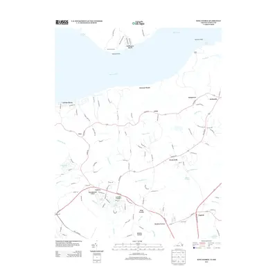
2013 Map of King George
USGS Topo · Published 2013About this map
The Potomac River shoreline and the inland communities of King George County are documented in this 2013 survey. The landscape transitions from waterfront residential pockets like Fairview Beach and Wellington Beach to established interior settlements such as Weedonville and the county seat at King George. Road networks such as Caledon Rd and Kings Hwy connect historic crossroads like Arnolds Corner and Comorn, reflecting the long-standing agricultural and residential patterns of the Virginia Northern Neck.
Find a feature on this map
112 named features on this map. Tap any name to fly to it.
Don’t see what you’re looking for? This feature index may not catch every label — zoom into the map to look around manually.
Map Details
Editions of this 2013 King George Map
This is the sole edition of this map. No revisions or reprints were ever made.
Other maps of this area

1889 · Fredericksburg
USGS Topo · 1:125,000

1892 · Fredericksburg
USGS Topo · 1:125,000

1894 · Fredericksburg
USGS Topo · 1:125,000

1913 · Nanjemoy
USGS Topo · 1:62,500

1926 · Stafford
USGS Topo · 1:62,500

1931 · Stafford
USGS Topo · 1:62,500

1942 · Rollins Fork
USGS Topo · 1:31,680

1942 · Port Royal
USGS Topo · 1:31,680

1942 · Rappahannock Academy
USGS Topo · 1:31,680
1944 · Widewater
USGS Topo · 1:31,680