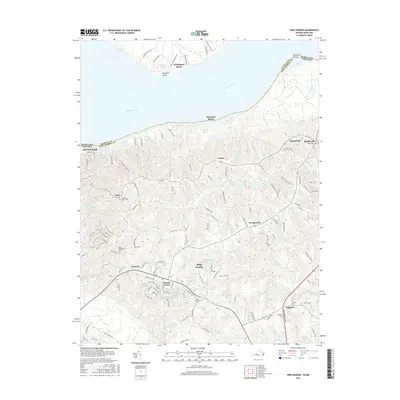
2016 Map of King George
USGS Topo · Published 2016About this map
King George sits at the heart of this coastal Virginia landscape, serving as a hub for a network of rural settlements and waterways along the Potomac River. The terrain is defined by a series of creeks and runs, including Upper Machodoc Cr and Chotank Cr, which carve through the interior toward the river's edge. This modern survey reflects the area's established residential and agricultural character, punctuated by historic religious and communal sites. Local heritage is deeply embedded in the land, as evidenced by numerous burial grounds such as Saint Pauls Cem and Hanover Cem.
Find a feature on this map
138 named features on this map. Tap any name to fly to it.
Don’t see what you’re looking for? This feature index may not catch every label — zoom into the map to look around manually.
Map Details
Editions of this 2016 King George Map
This is the sole edition of this map. No revisions or reprints were ever made.
Other maps of this area

1889 · Fredericksburg
USGS Topo · 1:125,000

1892 · Fredericksburg
USGS Topo · 1:125,000

1894 · Fredericksburg
USGS Topo · 1:125,000

1913 · Nanjemoy
USGS Topo · 1:62,500

1926 · Stafford
USGS Topo · 1:62,500

1931 · Stafford
USGS Topo · 1:62,500

1942 · Rollins Fork
USGS Topo · 1:31,680

1942 · Port Royal
USGS Topo · 1:31,680

1942 · Rappahannock Academy
USGS Topo · 1:31,680
1944 · Widewater
USGS Topo · 1:31,680