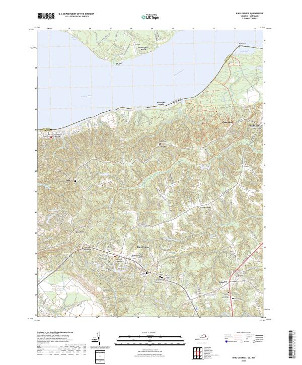
2022 Map of King George
USGS Topo · Published 2022About this map
The King George County Courthouse anchors this survey of Virginia's Northern Neck, where the landscape transitions from the tidal Potomac River into a network of creek-cut plateaus. Local genealogy is well-preserved through numerous ecclesiastical sites such as the Saint Pauls Episcopal Church Cemetery near Berthaville and the Trinity United Methodist Church Cem in the county seat. Along the shoreline, established riverfront communities like Fairview Beach and Wellington Beach sit across from the Maryland border, while inland settlements like Arnolds Corner and Comorn reflect the area's agricultural and crossroads heritage. Modern institutions such as the Rappahannock Community College King George Site are depicted alongside traditional landmarks like Historyland Memorial Park, illustrating a community that balances its historic seat of government with contemporary educational and residential growth.
Find a feature on this map
151 named features on this map. Tap any name to fly to it.
Don’t see what you’re looking for? This feature index may not catch every label — zoom into the map to look around manually.
Map Details
Editions of this 2022 King George Map
This is the sole edition of this map. No revisions or reprints were ever made.
Other maps of this area

1889 · Fredericksburg
USGS Topo · 1:125,000

1892 · Fredericksburg
USGS Topo · 1:125,000

1894 · Fredericksburg
USGS Topo · 1:125,000

1913 · Nanjemoy
USGS Topo · 1:62,500

1926 · Stafford
USGS Topo · 1:62,500

1931 · Stafford
USGS Topo · 1:62,500

1942 · Rollins Fork
USGS Topo · 1:31,680

1942 · Port Royal
USGS Topo · 1:31,680

1942 · Rappahannock Academy
USGS Topo · 1:31,680
1944 · Widewater
USGS Topo · 1:31,680