
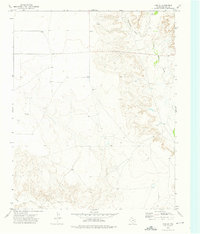
1973 Map of King SW
USGS Topo · Published 1975About this map
Punta de Agua Creek winds through the southern portion of this high plains landscape, carving a distinct drainage pattern into the Hartley County terrain. The northern and central sections of the sheet are characterized by expansive, relatively flat topography interspersed with localized depressions and ranching infrastructure. Working lands are evidenced by the presence of McMordie Pens and the settlement of Finch, while industrial activity is noted through scattered resource extraction sites like a Gravel Pit and a marked Drill Hole. The map reflects a mid-1970s snapshot of the Texas Panhandle, where the economy was rooted in cattle ranching and early petroleum exploration, shown by the sparse but deliberate placement of corrals and survey points across the wide-open prairie.
Find a feature on this map
5 named features on this map. Tap any name to fly to it.
Don’t see what you’re looking for? This feature index may not catch every label — zoom into the map to look around manually.
Map Details
Editions of this 1973 King SW Map
This is the sole edition of this map. No revisions or reprints were ever made.
Other maps of this area

1954 · Tucumcari
USGS Topo · 1:250,000

1958 · Tucumcari
USGS Topo · 1:250,000

1971 · Middle Water
USGS Topo · 1:24,000

1971 · Syndicate Hills
USGS Topo · 1:24,000

1971 · Proctor Ranch
USGS Topo · 1:24,000

1971 · Spring Creek Ranch
USGS Topo · 1:24,000

1971 · Pedarosa Camp
USGS Topo · 1:24,000

1973 · Pardue Camp
USGS Topo · 1:24,000

1973 · King
USGS Topo · 1:24,000
1973 · King SE
USGS Topo · 1:24,000