2022 Map of King
USGS Topo · Published 2022About this map
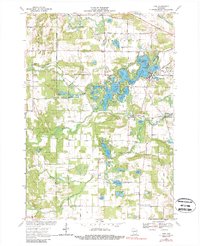
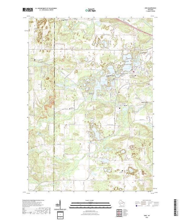
Chain O' Lakes dominates this landscape, forming a complex waterway of interconnected basins including Rainbow Lake, Columbia Lake, and Long Lake. The intricate shoreline is punctuated by distinct landmarks like Emmons Peninsula and Government Island, illustrating the glacial topography of central Wisconsin. To the east, the Waupaca River and Crystal River wind through the terrain near the small settlements of Rural and Parfreyville. The western portion of the map is defined by the protected lands of Hartman Creek State Park, where Hartman Lake and Marl Lake are situated. This modern survey provides a clear view of the area's local history and community hubs, including the Central Wisconsin Veterans Memorial Cem and several older burial grounds like Pleasant Valley Cem and Badger Cem.
Find a feature on this map
112 named features on this map. Tap any name to fly to it.
Don’t see what you’re looking for? This feature index may not catch every label — zoom into the map to look around manually.
Map Details
Editions of this 2022 King Map
This is the sole edition of this map. No revisions or reprints were ever made.