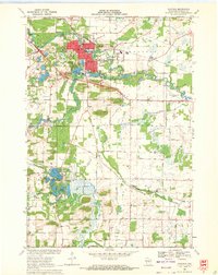
1969 Map of Waupaca
USGS Topo · Published 1972About this map
Waupaca serves as the focal point of this late 1960s survey, showing its development around the winding Waupaca River and several glacial lakes. The town center is densely built, containing the Armory, Waterworks, and the Waupaca High Sch. To the south and west, the landscape transitions into a mosaic of wetlands and small kettle lakes, such as Mirror Lake and Shadow Lake. Transport patterns are defined by the Soo Line railroad and a grid of rural roads like Townsend Road and Bunker Hill Road. The survey reveals a community balanced between industry and recreation, noting the Waupaca Country Club and the Drive-in Theater alongside local quarries. Scattered settlements like Little Hope and Lind Center remain connected by the winding Walla Walla Creek, illustrating the era's agricultural and small-town infrastructure.
Find a feature on this map
63 named features on this map. Tap any name to fly to it.
Don’t see what you’re looking for? This feature index may not catch every label — zoom into the map to look around manually.
Map Details
Editions of this 1969 Waupaca Map
This is the sole edition of this map. No revisions or reprints were ever made.
Other maps of this area

1955 · Green Bay
USGS Topo · 1:250,000

1956 · Weyauwega
USGS Topo · 1:48,000

1957 · Waupaca
USGS Topo · 1:48,000

1961 · Poy Sippi
USGS Topo · 1:62,500

1961 · Redgranite
USGS Topo · 1:62,500

1961 · Saxeville
USGS Topo · 1:24,000

1961 · Wild Rose
USGS Topo · 1:24,000
1961 · Poy Sippi
USGS Topo · 1:24,000
1969 · Manawa
USGS Topo · 1:24,000
1969 · Weyauwega
USGS Topo · 1:24,000