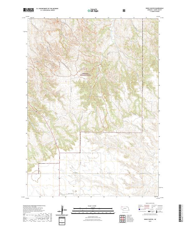
2021 Map of Kings Canyon
USGS Topo · Published 2021About this map
Nebraska National Forest encompasses much of this Dawes County landscape, characterized by the dramatic incision of Kings Canyon and Strong Canyon. The terrain is defined by the high tablelands and broken ridges typical of the Pine Ridge region, where watercourses like Big Bordeaux Cr and Chadron Cr carve through the sedimentary layers. This modern survey illustrates how recreation and utility have shaped the land, featuring an extensive network of managed paths including the Pine Ridge Mt Bike Trl and various designated spurs. Beyond the forest boundaries, the section lines of the Public Land Survey System organize the rural landscape into townships such as t32n r48w and t31n r48w. Local travel is facilitated by a grid of named routes like Table Rd and Prairie Home Rd, reflecting the enduring agricultural and ranching framework of the Nebraska Panhandle.
Find a feature on this map
24 named features on this map. Tap any name to fly to it.
Don’t see what you’re looking for? This feature index may not catch every label — zoom into the map to look around manually.
Map Details
Editions of this 2021 Kings Canyon Map
This is the sole edition of this map. No revisions or reprints were ever made.
Other maps of this area

1955 · Alliance
USGS Topo · 1:250,000

1957 · Alliance
USGS Topo · 1:250,000

1958 · Alliance
USGS Topo · 1:250,000

1966 · Chadron 3 SE
USGS Topo · 1:24,000

1966 · Chadron 3 NE
USGS Topo · 1:24,000
1966 · Chadron 3 SW
USGS Topo · 1:24,000

1969 · Bordeaux
USGS Topo · 1:24,000

1970 · Chadron 3 NW
USGS Topo · 1:24,000
1970 · Chadron East
USGS Topo · 1:24,000
1980 · Coffee Mill Butte SE
USGS Topo · 1:24,000