
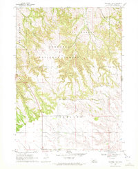
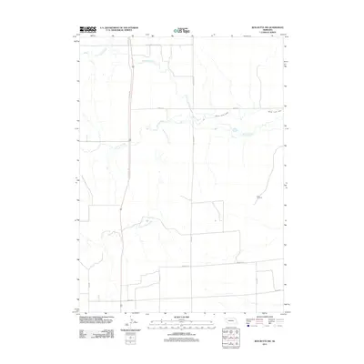
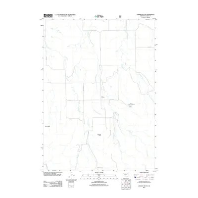
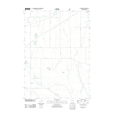
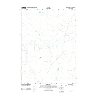
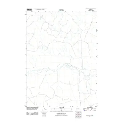
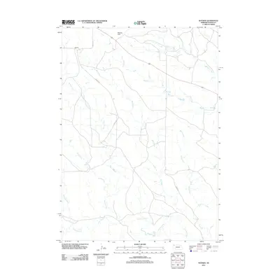
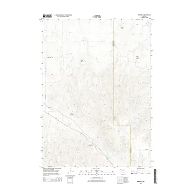
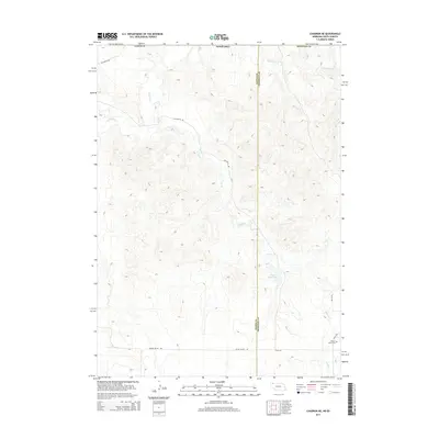
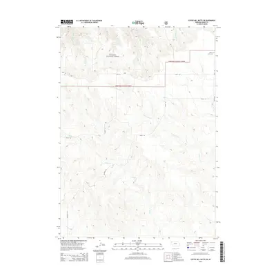
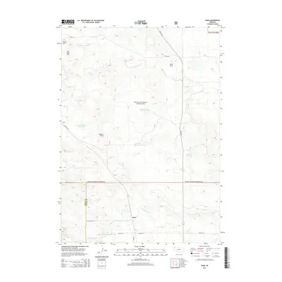
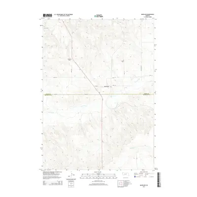
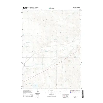
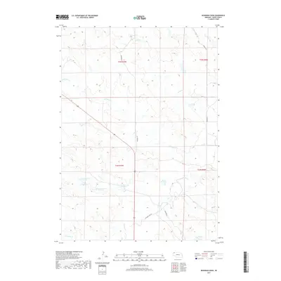
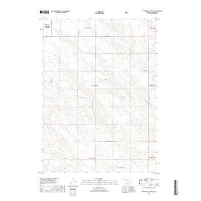
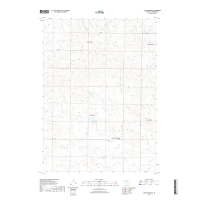
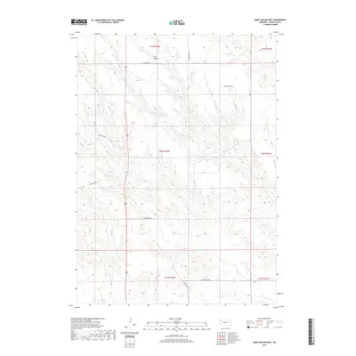
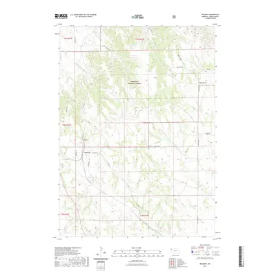
1970 Map of Kings Canyon
USGS Topo · Published 1993About this map
The Nebraska National Forest dominates this 1970 landscape, where the Pine Ridge escarpment gives way to complex drainage systems in Dawes County. Narrow canyons like Kings Canyon and Strong Canyon carve through the timbered uplands, feeding the north-flowing waters of West Chadron Creek and Bordeaux Creek. This era of the High Plains reflects a sparse but organized rural infrastructure, centered on localized water sources and the transition between wooded breaks and flat agricultural tables.
Find a feature on this map
13 named features on this map. Tap any name to fly to it.
Don’t see what you’re looking for? This feature index may not catch every label — zoom into the map to look around manually.
Map Details
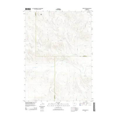
Editions of this 1970 Kings Canyon Map
2 editions found
Historical Maps of Dawes County Through Time
141 maps found

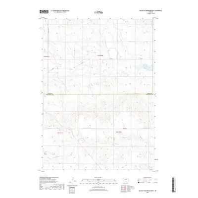
1946 Box Butte Reservoir West
Dawes County, NE

1947 Box Butte NW
Dawes County, NE

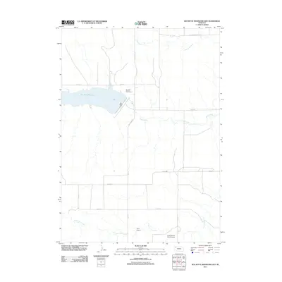
1948 Box Butte Reservoir East
Dawes County, NE

1948 Box Butte Reservoir West
Dawes County, NE

1949 Box Butte NW
Dawes County, NE

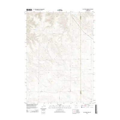
1966 Hay Springs Creek
Dawes County, NE

1966 Sand Canyon East
Dawes County, NE

1966 Sand Canyon West
Dawes County, NE

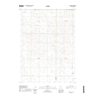
1969 Bordeaux
Dawes County, NE

1969 Chadron NE
Dawes County, NE

1970 Bohemian Creek
Dawes County, NE

1970 Chadron East
Dawes County, NE

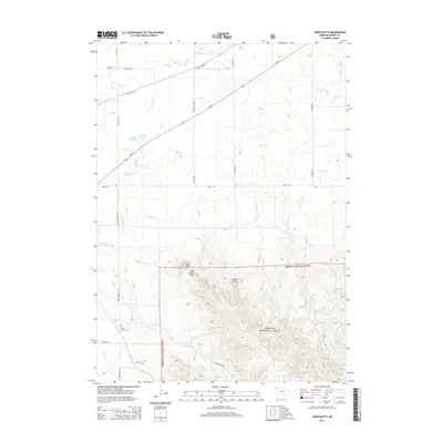
1970 Isinglass Buttes
Dawes County, NE
1970 Kings Canyon
Dawes County, NE

1980 Belmont
Dawes County, NE

1980 Chadron West
Dawes County, NE

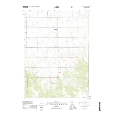
1980 Chimney Butte
Dawes County, NE

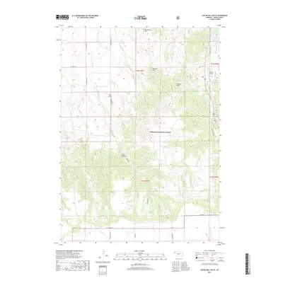
1980 Coffee Mill Butte
Dawes County, NE

1980 Coffee Mill Butte SE
Dawes County, NE

1980 Coffee Mill Butte SW
Dawes County, NE

1980 Crow Butte
Dawes County, NE

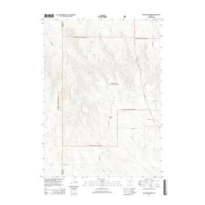
1980 Dead Mans Creek
Dawes County, NE

1980 Horn
Dawes County, NE

1980 Lone Tree Ranch
Dawes County, NE

1980 Trunk Butte
Dawes County, NE

1980 Wayside
Dawes County, NE

1980 Wolf Butte
Dawes County, NE

1983 Marsland
Dawes County, NE

1983 Marsland NW
Dawes County, NE
2011 Belmont
Dawes County, NE
2011 Bohemian Creek
Dawes County, NE
2011 Bordeaux
Dawes County, NE
2011 Box Butte NW
Dawes County, NE
2011 Box Butte Reservoir East
Dawes County, NE
2011 Box Butte Reservoir West
Dawes County, NE

2011 Chadron East
Dawes County, NE
2011 Chadron NE
Dawes County, NE

2011 Chadron West
Dawes County, NE
2011 Chimney Butte
Dawes County, NE
2011 Coffee Mill Butte
Dawes County, NE
2011 Coffee Mill Butte SE
Dawes County, NE
2011 Coffee Mill Butte SW
Dawes County, NE
2011 Crow Butte
Dawes County, NE
2011 Dead Mans Creek
Dawes County, NE
2011 Hay Springs Creek
Dawes County, NE
2011 Horn
Dawes County, NE
2011 Isinglass Buttes
Dawes County, NE
2011 Kings Canyon
Dawes County, NE
2011 Lone Tree Ranch
Dawes County, NE
2011 Marsland
Dawes County, NE
2011 Marsland NW
Dawes County, NE
2011 Sand Canyon East
Dawes County, NE
2011 Sand Canyon West
Dawes County, NE
2011 Trunk Butte
Dawes County, NE
2011 Wayside
Dawes County, NE
2011 Wolf Butte
Dawes County, NE
2014 Belmont
Dawes County, NE
2014 Bohemian Creek
Dawes County, NE
2014 Bordeaux
Dawes County, NE
2014 Box Butte NW
Dawes County, NE
2014 Box Butte Reservoir East
Dawes County, NE
2014 Box Butte Reservoir West
Dawes County, NE

2014 Chadron East
Dawes County, NE
2014 Chadron NE
Dawes County, NE

2014 Chadron West
Dawes County, NE
2014 Chimney Butte
Dawes County, NE
2014 Coffee Mill Butte
Dawes County, NE
2014 Coffee Mill Butte SE
Dawes County, NE
2014 Coffee Mill Butte SW
Dawes County, NE
2014 Crow Butte
Dawes County, NE
2014 Dead Mans Creek
Dawes County, NE
2014 Hay Springs Creek
Dawes County, NE
2014 Horn
Dawes County, NE
2014 Isinglass Buttes
Dawes County, NE
2014 Kings Canyon
Dawes County, NE
2014 Lone Tree Ranch
Dawes County, NE
2014 Marsland
Dawes County, NE
2014 Marsland NW
Dawes County, NE
2014 Sand Canyon East
Dawes County, NE
2014 Sand Canyon West
Dawes County, NE
2014 Trunk Butte
Dawes County, NE
2014 Wayside
Dawes County, NE
2014 Wolf Butte
Dawes County, NE
2017 Belmont
Dawes County, NE
2017 Bohemian Creek
Dawes County, NE
2017 Bordeaux
Dawes County, NE
2017 Box Butte NW
Dawes County, NE
2017 Box Butte Reservoir East
Dawes County, NE
2017 Box Butte Reservoir West
Dawes County, NE

2017 Chadron East
Dawes County, NE
2017 Chadron NE
Dawes County, NE

2017 Chadron West
Dawes County, NE
2017 Chimney Butte
Dawes County, NE
2017 Coffee Mill Butte
Dawes County, NE
2017 Coffee Mill Butte SE
Dawes County, NE
2017 Coffee Mill Butte SW
Dawes County, NE
2017 Crow Butte
Dawes County, NE
2017 Dead Mans Creek
Dawes County, NE
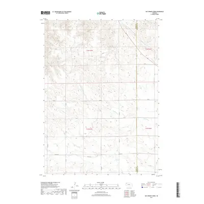
2017 Hay Springs Creek
Dawes County, NE
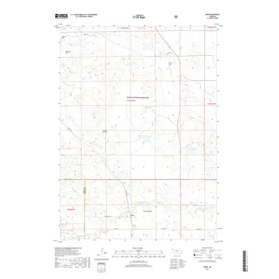
2017 Horn
Dawes County, NE
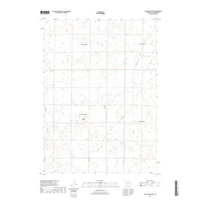
2017 Isinglass Buttes
Dawes County, NE
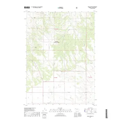
2017 Kings Canyon
Dawes County, NE
2017 Lone Tree Ranch
Dawes County, NE
2017 Marsland
Dawes County, NE
2017 Marsland NW
Dawes County, NE
2017 Sand Canyon East
Dawes County, NE
2017 Sand Canyon West
Dawes County, NE
2017 Trunk Butte
Dawes County, NE
2017 Wayside
Dawes County, NE
2017 Wolf Butte
Dawes County, NE
2021 Belmont
Dawes County, NE

2021 Bohemian Creek
Dawes County, NE
2021 Bordeaux
Dawes County, NE

2021 Box Butte NW
Dawes County, NE

2021 Box Butte Reservoir East
Dawes County, NE

2021 Box Butte Reservoir West
Dawes County, NE

2021 Chadron East
Dawes County, NE

2021 Chadron NE
Dawes County, NE

2021 Chadron West
Dawes County, NE

2021 Chimney Butte
Dawes County, NE

2021 Coffee Mill Butte
Dawes County, NE

2021 Coffee Mill Butte SE
Dawes County, NE

2021 Coffee Mill Butte SW
Dawes County, NE
2021 Crow Butte
Dawes County, NE

2021 Dead Mans Creek
Dawes County, NE

2021 Hay Springs Creek
Dawes County, NE

2021 Horn
Dawes County, NE

2021 Isinglass Buttes
Dawes County, NE

2021 Kings Canyon
Dawes County, NE

2021 Lone Tree Ranch
Dawes County, NE

2021 Marsland
Dawes County, NE

2021 Marsland NW
Dawes County, NE

2021 Sand Canyon East
Dawes County, NE

2021 Sand Canyon West
Dawes County, NE

2021 Trunk Butte
Dawes County, NE

2021 Wayside
Dawes County, NE

2021 Wolf Butte
Dawes County, NE

2023 Belmont
Dawes County, NE

2023 Bordeaux
Dawes County, NE

2023 Crow Butte
Dawes County, NE

2023 Marsland
Dawes County, NE