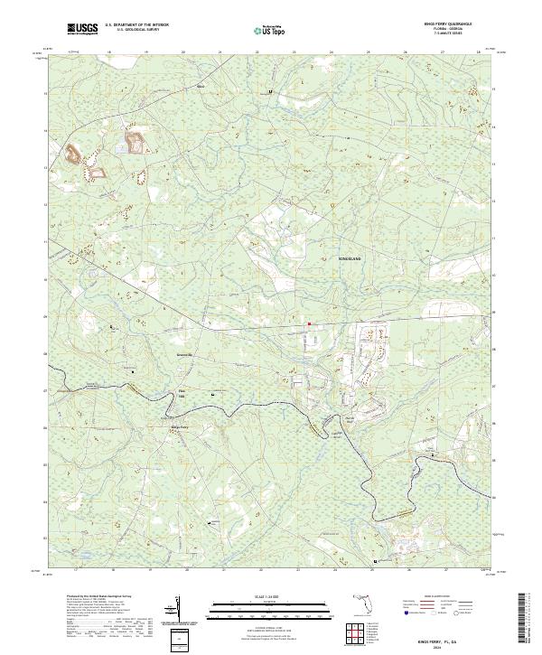
2024 Map of Kings Ferry
USGS Topo · Published 2024About this map
The Saint Marys River winds along the border between Florida and Georgia, defining the southern boundary of Camden County and the northern edge of Nassau County. This riverine landscape is characterized by prominent bluffs and bends, including Orange Bluff, Merries Bluff, and the sharp curve of Cabbage Bend. The small settlement of Kings Ferry sits near the riverbanks, serving as a focal point for local history alongside nearby Greenville and the southern edge of Kingsland.
Find a feature on this map
85 named features on this map. Tap any name to fly to it.
Don’t see what you’re looking for? This feature index may not catch every label — zoom into the map to look around manually.
Map Details
Editions of this 2024 Kings Ferry Map
This is the sole edition of this map. No revisions or reprints were ever made.
Other maps of this area

1917 · Boulogne
USGS Topo · 1:62,500

1917 · Hilliard
USGS Topo · 1:62,500

1918 · St Marys
USGS Topo · 1:62,500

1918 · Kingsland
USGS Topo · 1:62,500

1919 · St Marys
USGS Topo · 1:62,500

1919 · Hilliard
USGS Topo · 1:62,500

1919 · Boulogne
USGS Topo · 1:62,500

1948 · Jacksonville
USGS Topo · 1:250,000

1957 · Jacksonville
USGS Topo · 1:250,000

1958 · Gross
USGS Topo · 1:24,000