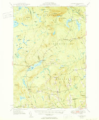
1950 Map of Kingsbury
USGS Topo · Published 1950About this map
Kingsbury sits at the heart of this mid-century landscape where the border of Somerset and Piscataquis counties meets a network of upland ponds and small settlements. The area is defined by a series of distinct corners—named crossroads like Mayfield Corner, Burdin Corner, and Hutchins Corner—that suggest a rural community structure organized around family landholdings and small-scale agriculture. This pattern of settlement is further evidenced by local landmarks such as the Campbell Sch and several small burial grounds including Foss Hill Cem and Taylor Cem.
Find a feature on this map
88 named features on this map. Tap any name to fly to it.
Don’t see what you’re looking for? This feature index may not catch every label — zoom into the map to look around manually.
Map Details
Editions of this 1950 Kingsbury Map
2 editions found

Other maps of this area

1903 · Bingham
USGS Topo · 1:62,500

1904 · Anson
USGS Topo · 1:62,500

1905 · Bingham
USGS Topo · 1:62,500

1905 · The Forks
USGS Topo · 1:62,500

1907 · The Forks
USGS Topo · 1:62,500

1913 · Skowhegan
USGS Topo · 1:62,500

1930 · Pittsfield
USGS Topo · 1:48,000

1932 · Pittsfield
USGS Topo · 1:62,500

1933 · Pittsfield
USGS Topo · 1:62,500

1933 · Guilford
USGS Topo · 1:62,500