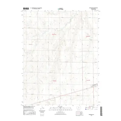
2016 Map of Kingsdown
USGS Topo · Published 2016About this map
Kingsdown occupies the southeastern corner of this Ford County landscape, where the local economy is anchored by infrastructure like Coop St and the surrounding grid of section roads. The terrain is defined by the drainage of Mulberry Cr, which cuts through the northern half of the quadrangle, creating a series of draws and ridges that contrast with the flatter agricultural plains to the south. Genealogists will find the Sodville Cem just outside the main settlement area, a key site for documenting the history of this rural community.
Find a feature on this map
26 named features on this map. Tap any name to fly to it.
Don’t see what you’re looking for? This feature index may not catch every label — zoom into the map to look around manually.
Map Details
Editions of this 2016 Kingsdown Map
This is the sole edition of this map. No revisions or reprints were ever made.
Other maps of this area

1892 · Spearville
USGS Topo · 1:125,000

1894 · Spearville
USGS Topo · 1:125,000

1896 · Ashland
USGS Topo · 1:125,000

1955 · Pratt
USGS Topo · 1:250,000

1959 · Pratt
USGS Topo · 1:250,000

1967 · Bloom
USGS Topo · 1:24,000
1969 · Fort Dodge SW
USGS Topo · 1:24,000

1969 · Fort Dodge
USGS Topo · 1:24,000

1969 · Bucklin
USGS Topo · 1:24,000

1969 · Kingsdown
USGS Topo · 1:24,000