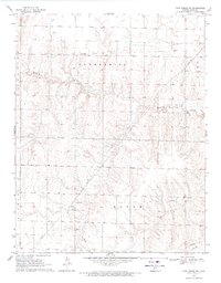
1969 Map of Fort Dodge SW
USGS Topo · Published 1971About this map
Mulberry Creek and its network of tributaries carve through the plains of Ford Co and Hodgeman Co in this 1969 field-checked survey. The landscape is defined by the expansive townships of Enterprise, Bloom, and Wilburn, where the traditional cattle-country terrain is overlaid with the infrastructure of the modern energy era. Extensive networks of Pipeline and Pipelines crisscross the region, supported by a central Compressor Station and a nearby Radio Tower. While much of the area is accessed via a primitive Jeep Trail, the map reveals a meticulously surveyed grid of elevation benchmarks, including BM 2493 and BM 2545, which trace the subtle rise and fall of the High Plains topography.
Find a feature on this map
16 named features on this map. Tap any name to fly to it.
Don’t see what you’re looking for? This feature index may not catch every label — zoom into the map to look around manually.
Map Details
Editions of this 1969 Fort Dodge SW Map
2 editions found
Other maps of this area

1892 · Meade
USGS Topo · 1:125,000

1892 · Dodge
USGS Topo · 1:125,000

1892 · Spearville
USGS Topo · 1:125,000

1894 · Spearville
USGS Topo · 1:125,000

1896 · Ashland
USGS Topo · 1:125,000

1955 · Pratt
USGS Topo · 1:250,000

1955 · Dodge City
USGS Topo · 1:250,000

1958 · Dodge City
USGS Topo · 1:250,000

1959 · Pratt
USGS Topo · 1:250,000

1959 · Dodge City
USGS Topo · 1:250,000