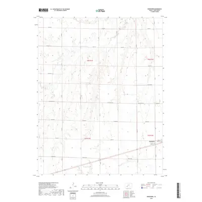
2018 Map of Kingsdown
USGS Topo · Published 2018About this map
Kingsdown and its surrounding agricultural landscape are defined by a rhythmic grid of rural routes, providing a detailed view of south-central Kansas during the late 2010s. The settlement occupies a small pocket in the southeast, situated along the intersection of local arteries like Windy Rd and Coop St. To its immediate east lies the Sodville Cem, a vital site for genealogical research in this portion of Ford County.
Find a feature on this map
19 named features on this map. Tap any name to fly to it.
Don’t see what you’re looking for? This feature index may not catch every label — zoom into the map to look around manually.
Map Details
Editions of this 2018 Kingsdown Map
This is the sole edition of this map. No revisions or reprints were ever made.
Other maps of this area

1892 · Spearville
USGS Topo · 1:125,000

1894 · Spearville
USGS Topo · 1:125,000

1896 · Ashland
USGS Topo · 1:125,000

1955 · Pratt
USGS Topo · 1:250,000

1959 · Pratt
USGS Topo · 1:250,000

1967 · Bloom
USGS Topo · 1:24,000
1969 · Fort Dodge SW
USGS Topo · 1:24,000

1969 · Fort Dodge
USGS Topo · 1:24,000

1969 · Bucklin
USGS Topo · 1:24,000

1969 · Kingsdown
USGS Topo · 1:24,000