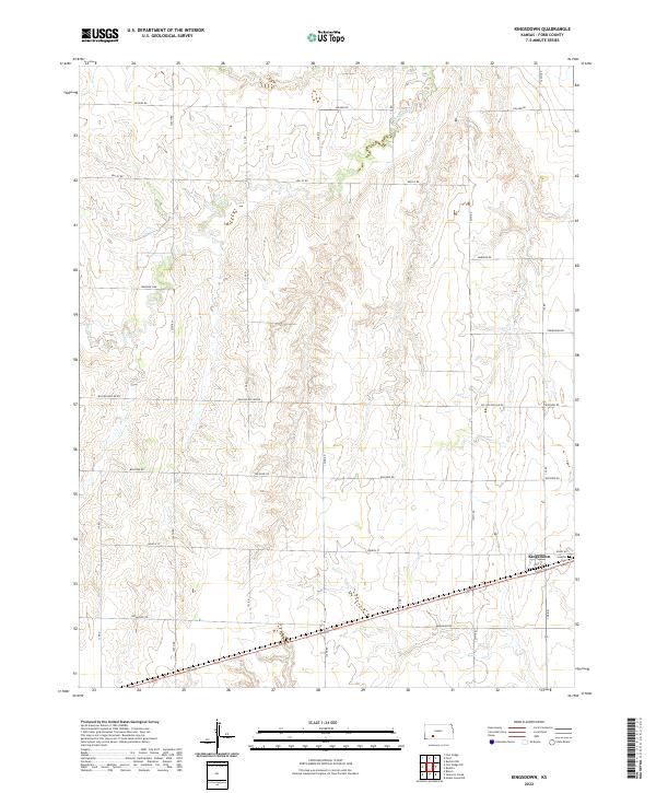
2022 Map of Kingsdown
USGS Topo · Published 2022About this map
Kingsdown serves as the primary focal point of this southwestern Kansas landscape, situated where the high plains begin to roll into the drainage of Mulberry Cr. The settlement pattern is defined by a rigorous section-line road grid, with many routes bearing evocative names such as Whirlwind Rd, Wildfire Rd, and the curiously titled Million Dollar Rd. Just east of the main townsite, Sodville Cem provides a vital link for genealogists researching the early families of Ford County. The survey illustrates a region shaped by agricultural geometry and the logistics of the southern plains, where life follows the straight lines of Church St and Wrangler Rd across the open terrain.
Find a feature on this map
19 named features on this map. Tap any name to fly to it.
Don’t see what you’re looking for? This feature index may not catch every label — zoom into the map to look around manually.
Map Details
Editions of this 2022 Kingsdown Map
This is the sole edition of this map. No revisions or reprints were ever made.
Other maps of this area

1892 · Spearville
USGS Topo · 1:125,000

1894 · Spearville
USGS Topo · 1:125,000

1896 · Ashland
USGS Topo · 1:125,000

1955 · Pratt
USGS Topo · 1:250,000

1959 · Pratt
USGS Topo · 1:250,000

1967 · Bloom
USGS Topo · 1:24,000
1969 · Fort Dodge SW
USGS Topo · 1:24,000

1969 · Fort Dodge
USGS Topo · 1:24,000

1969 · Bucklin
USGS Topo · 1:24,000

1969 · Kingsdown
USGS Topo · 1:24,000