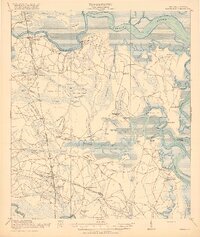
1918 Map of Kingsland
USGS Topo · Published 1918About this map
The coastal lowlands of Camden County, Georgia, and northern Nassau County, Florida, appear here as a complex network of tidal rivers and dense swamps during the late 1910s. The Seaboard Air Line railroad anchors the western corridor, connecting the established communities of Woodbine and Kingsland. The map reveals a landscape defined by water and forest products, evidenced by the Gross Still landmark and a Tramroad cutting through the northern swamps near a Refuge.
Find a feature on this map
89 named features on this map. Tap any name to fly to it.
Don’t see what you’re looking for? This feature index may not catch every label — zoom into the map to look around manually.
Map Details
Editions of this 1918 Kingsland Map
3 editions found
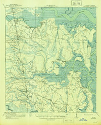
Other maps of this area

1917 · Nahunta
USGS Topo · 1:62,500

1917 · Boulogne
USGS Topo · 1:62,500

1917 · Hilliard
USGS Topo · 1:62,500

1918 · St Marys
USGS Topo · 1:62,500

1918 · Cumberland Island
USGS Topo · 1:62,500

1918 · Nahunta
USGS Topo · 1:62,500

1918 · Bladen
USGS Topo · 1:62,500

1918 · Kingsland
USGS Topo · 1:62,500

1919 · Fernandina
USGS Topo · 1:62,500

1919 · St Marys
USGS Topo · 1:62,500