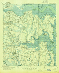
1918 Map of Kingsland
USGS Topo · Published 1944About this map
The Satilla River and Crooked River define this coastal landscape, where the tides push deep into intricate networks of tidal creeks and named swamps. Surveyed just before the close of World War I, the area shows a transition from water-based transport to a growing rail network. The Seaboard Air Line Railway runs north-south through Woodbine and Kingsland, while the Atlantic Waycross and Northern RR provides a vital east-west link from Kingsland toward the coast. Local industry and maritime life are evident at Sadlers Landing and the Gross Still. Small rural communities like Ceylon and Scotchville are anchored by social foundations like the Fairview Church and several community schools, including the Scrubby Bluff School and Greenville School, reflecting the settled interior between the coastal marshes and the St Marys River at the Florida border.
Find a feature on this map
98 named features on this map. Tap any name to fly to it.
Don’t see what you’re looking for? This feature index may not catch every label — zoom into the map to look around manually.
Map Details
Editions of this 1918 Kingsland Map
3 editions found
Other maps of this area

1917 · Nahunta
USGS Topo · 1:62,500

1917 · Boulogne
USGS Topo · 1:62,500

1917 · Hilliard
USGS Topo · 1:62,500

1918 · St Marys
USGS Topo · 1:62,500

1918 · Cumberland Island
USGS Topo · 1:62,500

1918 · Nahunta
USGS Topo · 1:62,500

1918 · Bladen
USGS Topo · 1:62,500

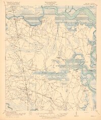
1918 · Kingsland
USGS Topo · 1:62,500

1919 · Fernandina
USGS Topo · 1:62,500

1919 · St Marys
USGS Topo · 1:62,500