Loading...
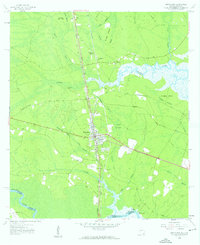
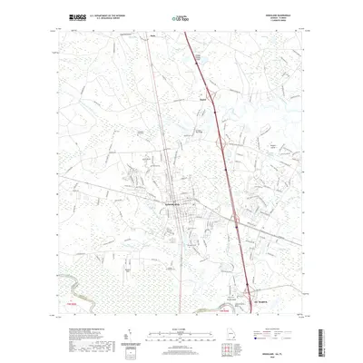
Loading map...1958 Map of Kingsland
USGS Topo · Published 1959About this map
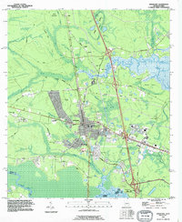
Kingsland serves as the focal point of this coastal Georgia landscape, situated at the intersection of the Seaboard Air Line and the Ocean Highway. This 1958 survey captures a community deeply connected to its river systems, where the St Marys River defines the southern boundary between Georgia and Florida. The map reveals a high density of small family and community burial grounds, such as Brazell Cem, Sheffield Cem, and Carlton Cem, which are invaluable for genealogists tracing South Georgia roots.
Find a feature on this map
40 named features on this map. Tap any name to fly to it.
Don’t see what you’re looking for? This feature index may not catch every label — zoom into the map to look around manually.
Map Details
Date Portrayed1958
Date Published1959
PublisherU.S. Geological Survey
Map TypeTopographic
Scale1:24,000
Physical Dimensions22 x 27 inches
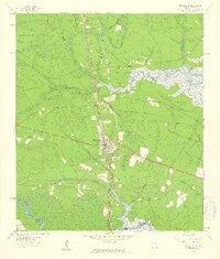
Editions of this 1958 Kingsland Map
2 editions found
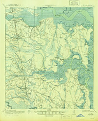
Historical Maps of St. Marys Through Time
9 maps found
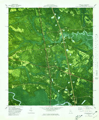
Featured Locations
Source Details
SourceU.S. Geological Survey
CopyrightPublic Domain