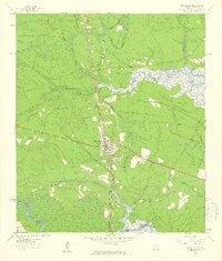
1958 Map of Kingsland
USGS Topo · Published 1959About this map
Kingsland serves as the central hub of this Georgia-Florida borderlands survey, situated where the Seaboard Air Line Railroad intersects a network of early regional thoroughfares like Colerain-St Marys Road and St Marys Road. The landscape is defined by its proximity to the winding St Marys River, which forms the boundary between Camden and Nassau counties. Extensive wetlands and tributaries such as Crooked River, Catfish Creek, and Shingle Swamp dictate the pattern of settlement, pushing small communities like Seals, Evergreen, and Kinlaw toward the higher ground of the interior. Genealogists will find a wealth of local data, including several family and community burial grounds like Sheffield Cem, Brazell Cem, and Lawnwood Cem. The presence of Carnegie Chapel and Evergreen Ch further illustrates the social geography of the coastal plain in the late 1950s.
Find a feature on this map
47 named features on this map. Tap any name to fly to it.
Don’t see what you’re looking for? This feature index may not catch every label — zoom into the map to look around manually.
Map Details
Editions of this 1958 Kingsland Map
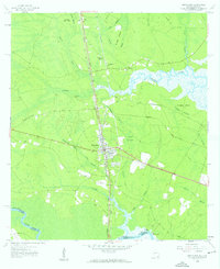
2 editions found
Other maps of this area

1917 · Boulogne
USGS Topo · 1:62,500

1917 · Hilliard
USGS Topo · 1:62,500

1918 · St Marys
USGS Topo · 1:62,500

1918 · Kingsland
USGS Topo · 1:62,500

1919 · St Marys
USGS Topo · 1:62,500

1919 · Hilliard
USGS Topo · 1:62,500

1919 · Boulogne
USGS Topo · 1:62,500

1948 · Jacksonville
USGS Topo · 1:250,000

1957 · Jacksonville
USGS Topo · 1:250,000

1958 · Gross
USGS Topo · 1:24,000