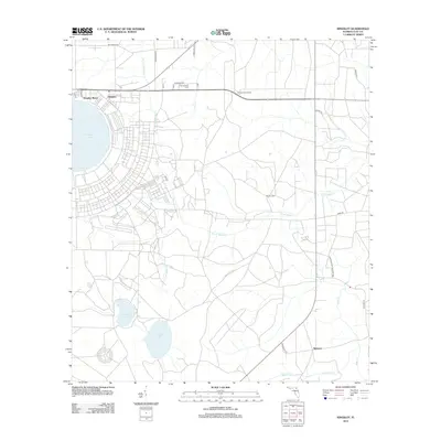
2012 Map of Kingsley
USGS Topo · Published 2012About this map
Kingsley Lake dominates the northwestern landscape, serving as a focal point for the lakeside communities of Kingsley Beach and Kingsley. This portion of Clay County reveals a distinct transition from these residential clusters into the structured expanse of the Camp Blanding Military Res to the south and east. The map records a series of water systems including N Fork Black Cr, S Fork Black Cr, and Ates Cr, which define the drainage patterns of this wooded region.
Find a feature on this map
27 named features on this map. Tap any name to fly to it.
Don’t see what you’re looking for? This feature index may not catch every label — zoom into the map to look around manually.
Map Details
Editions of this 2012 Kingsley Map
This is the sole edition of this map. No revisions or reprints were ever made.
Other maps of this area

1918 · Middleburg
USGS Topo · 1:62,500

1918 · Lawtey
USGS Topo · 1:62,500

1941 · Starke
USGS Topo · 1:62,500

1941 · Middleburg
USGS Topo · 1:62,500

1942 · Ates Creek
USGS Topo · 1:62,500

1948 · Starke
USGS Topo · 1:50,000

1948 · Jacksonville
USGS Topo · 1:250,000

1949 · Rice Creek
USGS Topo · 1:24,000

1949 · Middleburg SW
USGS Topo · 1:24,000

1949 · Gold Head Branch
USGS Topo · 1:24,000