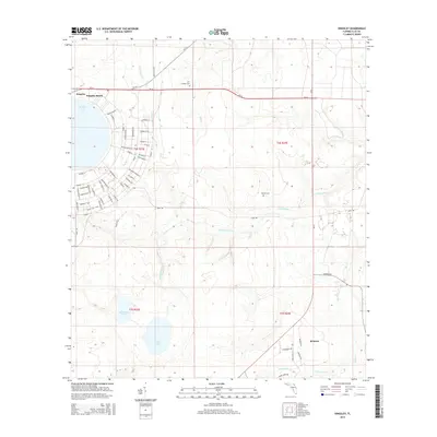
2015 Map of Kingsley
USGS Topo · Published 2015About this map
Kingsley Lake dominates the northwest corner of this Clay County landscape, where the settlements of Kingsley and Kingsley Beach occupy the shoreline. The surrounding terrain is defined by the branching hydrography of the Black Creek system, including the N Fork Black Cr and S Fork Black Cr, which carve through the woodland. For those researching local heritage, the map identifies the Old Conway Cem near SR-16 and the Beulah Cem further south. The southern portion of the quadrangle shows a more dispersed settlement pattern around Belmore, while a dense grid of streets—bearing names of Florida cities like Ocala St and Fort Myers St—suggests significant residential planning or development inland from the lakes. Further south, Whitmore Lake and Varnes Lake sit within a landscape increasingly crisscrossed by small watercourses like Devils Den Cr.
Find a feature on this map
66 named features on this map. Tap any name to fly to it.
Don’t see what you’re looking for? This feature index may not catch every label — zoom into the map to look around manually.
Map Details
Editions of this 2015 Kingsley Map
This is the sole edition of this map. No revisions or reprints were ever made.
Other maps of this area

1918 · Middleburg
USGS Topo · 1:62,500

1918 · Lawtey
USGS Topo · 1:62,500

1941 · Starke
USGS Topo · 1:62,500

1941 · Middleburg
USGS Topo · 1:62,500

1942 · Ates Creek
USGS Topo · 1:62,500

1948 · Starke
USGS Topo · 1:50,000

1948 · Jacksonville
USGS Topo · 1:250,000

1949 · Rice Creek
USGS Topo · 1:24,000

1949 · Middleburg SW
USGS Topo · 1:24,000

1949 · Gold Head Branch
USGS Topo · 1:24,000