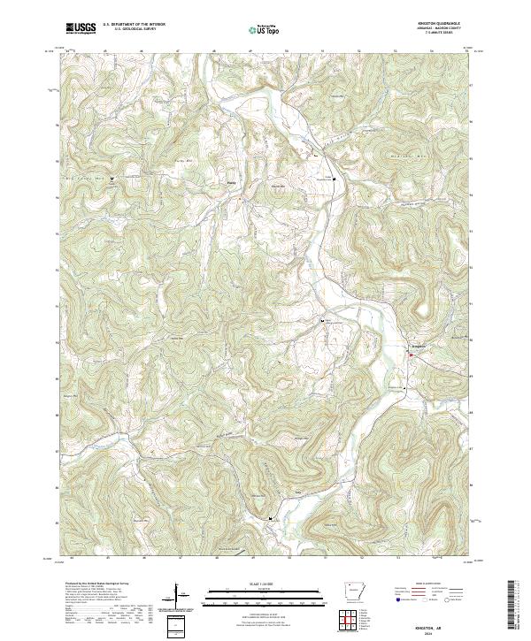
2024 Map of Kingston
USGS Topo · Published 2024About this map
Kings River carves a winding path through this corner of Madison County, framing a landscape defined by prominent peaks and narrow valleys. The settlement of Kingston sits near the confluence of several streams, including Sweden Creek and the river, serving as a focal point for the surrounding rural highlands. To the northwest, the community of Purdy rests near Purdy Mtn, while Loy occupies the southern reaches near Parson Hill. The distribution of family-named landmarks, such as Slaven Mtn, McArthur Mtn, and Yates Mtn, reflects generations of local history and land ownership across these ridges.
Find a feature on this map
104 named features on this map. Tap any name to fly to it.
Don’t see what you’re looking for? This feature index may not catch every label — zoom into the map to look around manually.
Map Details
Editions of this 2024 Kingston Map
This is the sole edition of this map. No revisions or reprints were ever made.
Other maps of this area

1900 · Eureka Springs
USGS Topo · 1:125,000

1901 · Eureka Springs
USGS Topo · 1:125,000

1904 · Harrison
USGS Topo · 1:125,000

1905 · Harrison
USGS Topo · 1:125,000

1945 · Harrison
USGS Topo · 1:250,000

1949 · Harrison
USGS Topo · 1:250,000

1954 · Harrison
USGS Topo · 1:250,000

1956 · Russellville
USGS Topo · 1:250,000

1958 · Harrison
USGS Topo · 1:250,000

1964 · Russellville
USGS Topo · 1:250,000