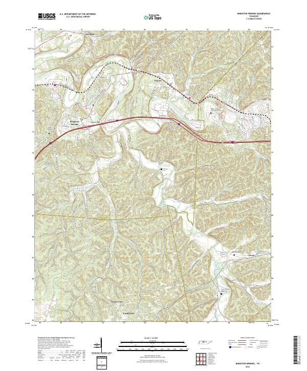
2022 Map of Kingston Springs
USGS Topo · Published 2022About this map
The Harpeth River carves a winding path through the heart of this region where Cheatham, Davidson, and Williamson counties converge. The rugged topography is defined by narrow ridges like Gourley Ridge and deep hollows such as Bell Hollow and Hatcher Hollow. The river’s course dictates the placement of long-standing communities, with Kingston Springs and Pegram following its northern banks along the Us HWY 70 corridor. Further south, the landscape transitions into a network of smaller drainages like Brush Creek and Jones Cr.
Find a feature on this map
96 named features on this map. Tap any name to fly to it.
Don’t see what you’re looking for? This feature index may not catch every label — zoom into the map to look around manually.
Map Details
Editions of this 2022 Kingston Springs Map
This is the sole edition of this map. No revisions or reprints were ever made.
Other maps of this area

1901 · Colombia
USGS Topo · 1:125,000

1903 · Nashville
USGS Topo · 1:125,000

1909 · Franklin
USGS Topo · 1:62,500

1930 · White Bluff
USGS Topo · 1:62,500

1932 · Nashville
USGS Topo · 1:62,500

1933 · White Bluff
USGS Topo · 1:62,500

1936 · Craigfield
USGS Topo · 1:24,000

1946 · Leipers Fork
USGS Topo · 1:24,000

1949 · Leipers Fork
USGS Topo · 1:24,000

1951 · Fairview
USGS Topo · 1:24,000