
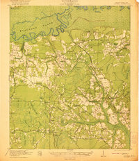
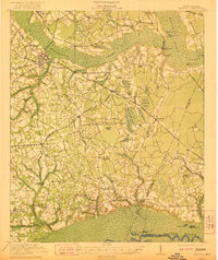
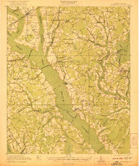
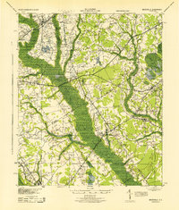
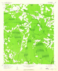
1946 Map of Kingstree
USGS Topo · Published 1946About this map
Black River meanders across this mid-century landscape of Williamsburg County, anchoring a region defined by its swamps and the Atlantic Coast Line railroad. The county seat of Kingstree serves as the primary hub, characterized at this time by its Disposal Plant, Airway Beacon, and a sprawling network of nearby schools such as the Oak Grove Sch and Bethlehem Sch. To the south, the village of Lane marks a significant rail junction, located near the Lane Fire Tower.
Find a feature on this map
110 named features on this map. Tap any name to fly to it.
Don’t see what you’re looking for? This feature index may not catch every label — zoom into the map to look around manually.
Map Details
Editions of this 1946 Kingstree Map
This is the sole edition of this map. No revisions or reprints were ever made.
Other maps of this area

1920 · Chicora
USGS Topo · 1:48,000

1920 · Mayesville
USGS Topo · 1:48,000

1920 · Manning
USGS Topo · 1:48,000
1921 · Chicora
USGS Topo · 1:62,500
1921 · Manning
USGS Topo · 1:62,500
1921 · Mayesville
USGS Topo · 1:62,500

1943 · Chicora
USGS Topo · 1:62,500
1943 · Mayesville
USGS Topo · 1:62,500
1943 · Trio
USGS Topo · 1:24,000
1943 · Bonneau
USGS Topo · 1:62,500