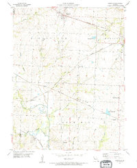
1954 Map of Kingsville
USGS Topo · Published 1955About this map
Kingsville and the surrounding townships of Kingsville, Madison, and Rose Hill are defined by a dense intersection of mid-century rail lines. Four major carriers, including the Missouri Pacific and the Chicago Kansas City and Rock Island Pacific, crisscross the undulating prairie, supporting small agricultural hubs like Latour and Medford. This network reflects a period when rail remained the primary artery for Johnson County's rural economy, connecting remote farmsteads to larger markets.
Find a feature on this map
39 named features on this map. Tap any name to fly to it.
Don’t see what you’re looking for? This feature index may not catch every label — zoom into the map to look around manually.
Map Details
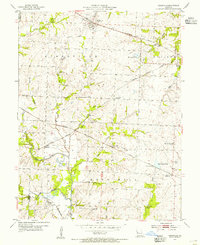
Editions of this 1954 Kingsville Map
2 editions found
Other maps of this area

1885 · Warrensburg
USGS Topo · 1:125,000

1887 · Harrisonville
USGS Topo · 1:125,000

1887 · Warrensburg
USGS Topo · 1:125,000

1892 · Harrisonville
USGS Topo · 1:125,000

1894 · Harrisonville
USGS Topo · 1:125,000

1894 · Warrensburg
USGS Topo · 1:125,000

1947 · Jefferson City
USGS Topo · 1:250,000

1947 · Lawrence
USGS Topo · 1:250,000

1950 · Lawrence
USGS Topo · 1:250,000

1954 · Jefferson City
USGS Topo · 1:250,000