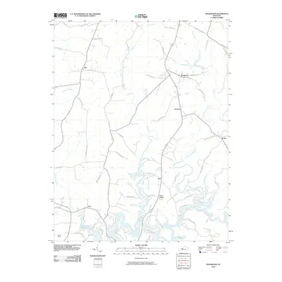
2010 Map of Kingswood
USGS Topo · Published 2010About this map
Rough River Reservoir dominates the southern landscape of this Breckinridge County region, where the fingers of the impounded waterway reach deep into the surrounding valleys. The winding course of the North Fork Rough River feeds this reservoir, carving through a terrain marked by small, dispersed rural settlements. Communities like Kingswood, Westview, and Axtel serve as local hubs connected by a network of family-named roads such as Joe Mattingly Rd and Morton Brown Rd. The presence of Sand Knob Cemetery Rd near the prominent elevation of Sand Knob provides a specific point of interest for genealogists tracing local families. The map details a transition from the upland ridges near Kirk to the low-lying shoreline developments around Tules Creek, reflecting the modern character of this Kentucky lakeside area.
Find a feature on this map
55 named features on this map. Tap any name to fly to it.
Don’t see what you’re looking for? This feature index may not catch every label — zoom into the map to look around manually.
Map Details
Editions of this 2010 Kingswood Map
This is the sole edition of this map. No revisions or reprints were ever made.
Other maps of this area

1928 · Hardinsburg
USGS Topo · 1:48,000

1931 · Hardinsburg
USGS Topo · 1:62,500

1932 · Fordsville
USGS Topo · 1:62,500

1934 · Cannelton
USGS Topo · 1:62,500

1947 · Hardinsburg
USGS Topo · 1:24,000

1947 · Garfield
USGS Topo · 1:24,000

1947 · Hardinsburg
USGS Topo · 1:62,500

1953 · Custer
USGS Topo · 1:24,000

1953 · Mc Daniels
USGS Topo · 1:24,000

1953 · Hardinsburg
USGS Topo · 1:24,000