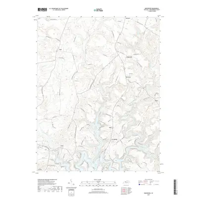
2019 Map of Kingswood
USGS Topo · Published 2019About this map
Rough River Lake and its winding northern fingers dominate the southern portion of this Breckinridge County landscape, where the N Fork Rough River meets the main body of water. The topography is defined by the dendritic drainage patterns of Tules Cr and Buffalo Cr, which carve through the plateau toward the river valley. Local settlements like Harned and Kingswood anchor the northern reaches, connected by a network of rural routes that preserve the names of early families and community landmarks. Researchers can find traces of local heritage in the naming of Sand Knob Cemetery Rd and the Kingswood Mattingly Sch Rd, which hint at the location of former civic centers and burial grounds near the village of Axtel. The map illustrates the contemporary rural character of this region, balancing agricultural land with the protected hydrography of the Rough River watershed.
Find a feature on this map
101 named features on this map. Tap any name to fly to it.
Don’t see what you’re looking for? This feature index may not catch every label — zoom into the map to look around manually.
Map Details
Editions of this 2019 Kingswood Map
This is the sole edition of this map. No revisions or reprints were ever made.
Other maps of this area

1928 · Hardinsburg
USGS Topo · 1:48,000

1931 · Hardinsburg
USGS Topo · 1:62,500

1932 · Fordsville
USGS Topo · 1:62,500

1934 · Cannelton
USGS Topo · 1:62,500

1947 · Hardinsburg
USGS Topo · 1:24,000

1947 · Garfield
USGS Topo · 1:24,000

1947 · Hardinsburg
USGS Topo · 1:62,500

1953 · Custer
USGS Topo · 1:24,000

1953 · Mc Daniels
USGS Topo · 1:24,000

1953 · Hardinsburg
USGS Topo · 1:24,000