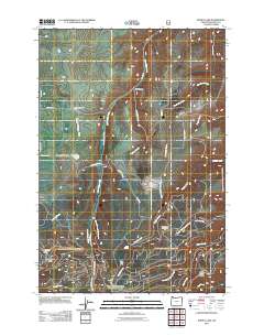
2011 Map of Kinney Lake
USGS Topo · Published 2011About this map
Kinney Lake and its associated Mountain Sheep Dam anchor this high-elevation landscape in the northeastern corner of Wallowa County. The terrain is defined by a dense network of seasonal and perennial drainages including Little Sheep Creek, Twobuck Creek, and the headwaters of Rail Canyon. Human activity in this remote region is largely centered on water management and seasonal livestock operations, evidenced by the Wallowa Valley Improvement Canal and the presence of the Divide Cow Camp near Cold Springs. Much of the eastern portion of the sheet falls within the Hells Canyon National Rec Area, where prominent landforms like Ferguson Ridge and White Horse Ridge overlook the deep canyons. Access to the backcountry is provided by the Imnaha Hwy and a system of forest roads such as Wallowa Mountain Rd and Target Divide Rd.
Find a feature on this map
32 named features on this map. Tap any name to fly to it.
Don’t see what you’re looking for? This feature index may not catch every label — zoom into the map to look around manually.
Map Details
Editions of this 2011 Kinney Lake Map
This is the sole edition of this map. No revisions or reprints were ever made.
Other maps of this area

1954 · Cornucopia
USGS Topo · 1:62,500

1954 · Harl Butte
USGS Topo · 1:62,500

1955 · Grangeville
USGS Topo · 1:250,000

1957 · Joseph
USGS Topo · 1:62,500

1957 · Homestead
USGS Topo · 1:62,500

1959 · Grangeville
USGS Topo · 1:250,000

1986 · Enterprise
USGS Topo · 1:100,000

1987 · Riggins
USGS Topo · 1:100,000
1990 · Gumboot Butte
USGS Topo · 1:24,000
1990 · Joseph
USGS Topo · 1:24,000