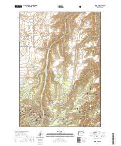
2020 Map of Kinney Lake
USGS Topo · Published 2020About this map
Wallowa National Forest land dominates this high-elevation landscape, where the Wallowa Valley Improvement Canal traces a complex path through the foothills. The map documents a rugged hydrographic system defined by prominent drainages like Little Sheep Cr, McCully Cr, and Griffith Cr. Named for its central water feature, Kinney Lake sits nestled below the higher elevations of Ferguson Ridge, while Papoose Lake marks the southwestern terrain. The infrastructure of the area is largely defined by backcountry access, including the Wallowa Mountain Loop and several specialized routes such as the Divide Snowmobile trail. These paths provide access to distinctive landmarks like Sheep Creek Hill Summit and the high vistas of White Horse Ridge.
Find a feature on this map
44 named features on this map. Tap any name to fly to it.
Don’t see what you’re looking for? This feature index may not catch every label — zoom into the map to look around manually.
Map Details
Editions of this 2020 Kinney Lake Map
This is the sole edition of this map. No revisions or reprints were ever made.
Other maps of this area

1954 · Cornucopia
USGS Topo · 1:62,500

1954 · Harl Butte
USGS Topo · 1:62,500

1955 · Grangeville
USGS Topo · 1:250,000

1957 · Joseph
USGS Topo · 1:62,500

1957 · Homestead
USGS Topo · 1:62,500

1959 · Grangeville
USGS Topo · 1:250,000

1986 · Enterprise
USGS Topo · 1:100,000

1987 · Riggins
USGS Topo · 1:100,000
1990 · Gumboot Butte
USGS Topo · 1:24,000
1990 · Joseph
USGS Topo · 1:24,000