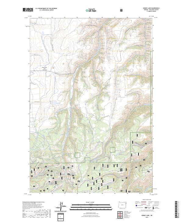
2023 Map of Kinney Lake
USGS Topo · Published 2023About this map
Kinney Lake lies at the heart of this mountainous landscape in the northeastern corner of Oregon, where the high-elevation terrain of the Wallowa National Forest drops into deep canyons and gulches. The map documents an intricate water management system designed to harness the snowmelt of the high country, most notably the Wallowa Valley Improvement Canal and Canal Creek. These diversions illustrate the long-standing efforts to move water from the wilderness of the Wallowa Mountain Loop toward the agricultural valleys below.
Find a feature on this map
46 named features on this map. Tap any name to fly to it.
Don’t see what you’re looking for? This feature index may not catch every label — zoom into the map to look around manually.
Map Details
Editions of this 2023 Kinney Lake Map
This is the sole edition of this map. No revisions or reprints were ever made.
Other maps of this area

1954 · Cornucopia
USGS Topo · 1:62,500

1954 · Harl Butte
USGS Topo · 1:62,500

1955 · Grangeville
USGS Topo · 1:250,000

1957 · Joseph
USGS Topo · 1:62,500

1957 · Homestead
USGS Topo · 1:62,500

1959 · Grangeville
USGS Topo · 1:250,000

1986 · Enterprise
USGS Topo · 1:100,000

1987 · Riggins
USGS Topo · 1:100,000
1990 · Gumboot Butte
USGS Topo · 1:24,000
1990 · Joseph
USGS Topo · 1:24,000