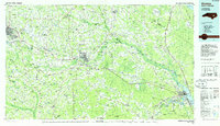
1985 Map of Kinston
USGS Topo · Published 1985About this map
The Neuse River and Trent River systems anchor this 1985 survey of Eastern North Carolina, documenting a landscape where agricultural traditions meet military and educational growth. Large pocosin wetlands like Big Pocosin and Half Moon Pocosin define the eastern terrain, while the city of Kinston serves as a central hub for the surrounding rural communities of Wheat Swamp, Institute, and Bucklesberry. The era's infrastructure is prominently marked by the Seymour Johnson Air Force Base near Goldsboro and the massive Voice of America Radio Towers situated further east.
Find a feature on this map
194 named features on this map. Tap any name to fly to it.
Don’t see what you’re looking for? This feature index may not catch every label — zoom into the map to look around manually.
Map Details
Editions of this 1985 Kinston Map
2 editions found
Other maps of this area

1901 · New Bern
USGS Topo · 1:62,500

1902 · Kenly
USGS Topo · 1:62,500

1902 · Ayden
USGS Topo · 1:62,500

1902 · Vanceboro
USGS Topo · 1:62,500

1903 · Kenly
USGS Topo · 1:62,500

1903 · New Bern
USGS Topo · 1:62,500

1903 · Winterville
USGS Topo · 1:62,500

1903 · Trent River
USGS Topo · 1:62,500

1903 · Chocowinity
USGS Topo · 1:62,500

1904 · Ayden
USGS Topo · 1:62,500