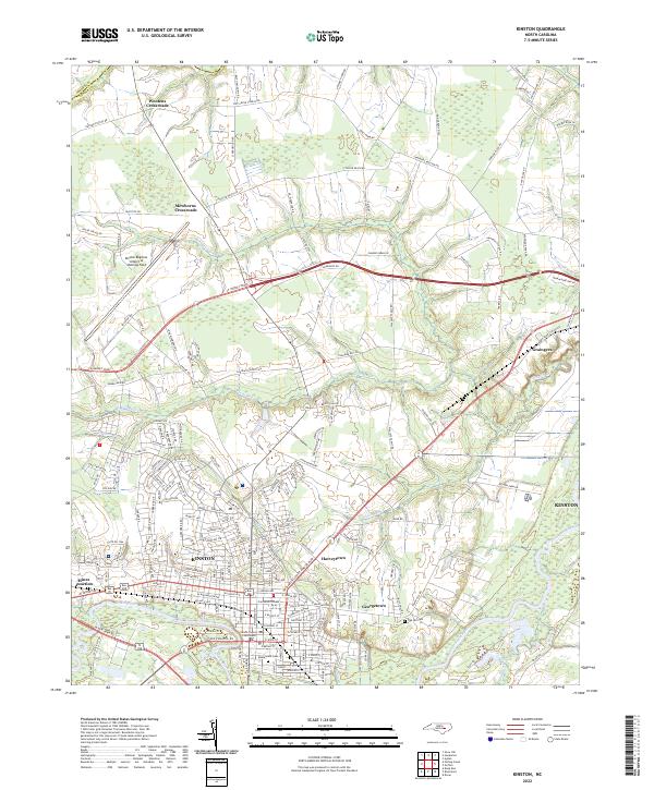
2022 Map of Kinston
USGS Topo · Published 2022About this map
Kinston serves as the focal point of this Eastern North Carolina landscape, where the Neuse River winds through the southern portion of the quadrangle. The city's civic heart is anchored by the Lenoir County Courthouse, while its periphery shows the established neighborhoods of Harveytown and Georgetown. The transition from urban center to rural farmland is marked by several named intersections, including Wootens Crossroads and Mewborns Crossroads, which reflect historical settlement patterns and family-owned lands in Lenoir County.
Find a feature on this map
64 named features on this map. Tap any name to fly to it.
Don’t see what you’re looking for? This feature index may not catch every label — zoom into the map to look around manually.
Map Details
Editions of this 2022 Kinston Map
This is the sole edition of this map. No revisions or reprints were ever made.
Other maps of this area

1902 · Ayden
USGS Topo · 1:62,500

1903 · Trent River
USGS Topo · 1:62,500

1904 · Ayden
USGS Topo · 1:62,500

1904 · Trent River
USGS Topo · 1:62,500

1914 · Kinston
USGS Topo · 1:48,000

1916 · Kinston
USGS Topo · 1:62,500

1953 · Rocky Mount
USGS Topo · 1:250,000

1954 · Rocky Mount
USGS Topo · 1:250,000

1958 · Deep Run
USGS Topo · 1:62,500
1980 · Deep Run
USGS Topo · 1:24,000