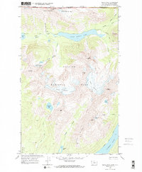
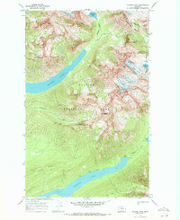
1968 Map of Kintla Peak
USGS Topo · Published 1972About this map
The international border between the United States and Canada defines the northern edge of this high-altitude landscape within Glacier National Park. Dominating the central terrain are massive ice fields including Kintla Glacier, Agassiz Glacier, and the smaller Baby Glacier, which feed a complex network of alpine drainages. Water moves from these heights into deep glacial troughs like that of Upper Kintla Lake and Bowman Lake. Remote backcountry infrastructure is visible through the Patrol Cabin near the western shore of Kintla Lake and a series of primitive campsites. The map illustrates the 1960s state of these receding glaciers and the high-elevation passage afforded by the Boulder Pass Trail, which skirts beneath Kintla Peak and Kinnerly Peak while connecting the drainage systems of Kintla Creek and Agassiz Creek.
Find a feature on this map
38 named features on this map. Tap any name to fly to it.
Don’t see what you’re looking for? This feature index may not catch every label — zoom into the map to look around manually.
Map Details
Editions of this 1968 Kintla Peak Map
2 editions found
Other maps of this area

1906 · Kintla Lakes
USGS Topo · 1:125,000

1938 · Kintla Lakes
USGS Topo · 1:125,000

1957 · Kalispell
USGS Topo · 1:250,000

1960 · Kalispell
USGS Topo · 1:250,000

1961 · Kalispell
USGS Topo · 1:250,000

1966 · Kintla Lake
USGS Topo · 1:24,000
1966 · Polebridge
USGS Topo · 1:24,000
1968 · Quartz Ridge
USGS Topo · 1:24,000
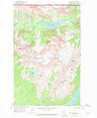
1968 · Kintla Peak
USGS Topo · 1:24,000
1968 · Vulture Peak
USGS Topo · 1:24,000