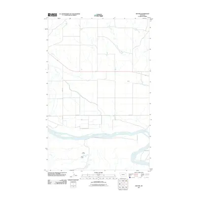
2011 Map of Kintyre
USGS Topo · Published 2011About this map
The Missouri River dominates the southern landscape of this 2011 survey, serving as a primary geographical anchor for the rural expanse of Valley County. Near the center of the sheet, the small settlement of Kintyre sits north of the river, surrounded by a network of drainage systems including Charley Creek, Kintyre Creek, and Lost Creek. The map reveals a land managed for water and transport, evidenced by the presence of Heifer Pen Dam situated near Sarge Coulee. Local infrastructure is defined by a series of named rural routes such as Blackwalnut Rd, Nickels Rd, and the Indian Hwy, which provide the essential framework for this agricultural and riparian region. This detailed topographic study offers a precise look at the prairie and river-bottom environment, tracing the ways in which water resources and roads intersect in the Montana plains.
Find a feature on this map
12 named features on this map. Tap any name to fly to it.
Don’t see what you’re looking for? This feature index may not catch every label — zoom into the map to look around manually.
Map Details
Editions of this 2011 Kintyre Map
This is the sole edition of this map. No revisions or reprints were ever made.
Other maps of this area

1914 · Nashua
USGS Topo · 1:62,500

1915 · Frazer
USGS Topo · 1:62,500

1916 · Nashua
USGS Topo · 1:62,500

1954 · Jordan
USGS Topo · 1:250,000

1954 · Glasgow
USGS Topo · 1:250,000

1956 · Jordan
USGS Topo · 1:250,000

1957 · Glasgow
USGS Topo · 1:250,000

1958 · Glasgow
USGS Topo · 1:250,000

1958 · Jordan
USGS Topo · 1:250,000

1964 · Jordan
USGS Topo · 1:250,000