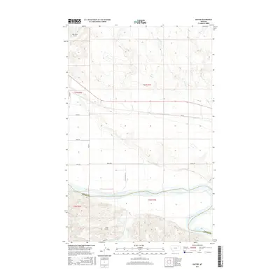
2017 Map of Kintyre
USGS Topo · Published 2017About this map
Kintyre sits as a quiet settlement in Valley County, Montana, situated between the winding currents of the Missouri River to the south and the high plains of the northern border. The terrain is defined by its drainage patterns, notably Sarge Coulee and the branching waters of Milk River Coulee and Charley Cr. This landscape reflects a late-20th-century transition in rural infrastructure, where modern roads like Indian Hwy and Bia Rte 1 follow the section lines established by the original land surveys. The map traces the county boundary between Valley and McCone Counties as it follows the main channel of the Missouri. This document provides a record of the intricate coulees and seasonal creeks, such as Lost Cr and W Fork Lost Cr, that carve through the high ground above the river valley.
Find a feature on this map
20 named features on this map. Tap any name to fly to it.
Don’t see what you’re looking for? This feature index may not catch every label — zoom into the map to look around manually.
Map Details
Editions of this 2017 Kintyre Map
This is the sole edition of this map. No revisions or reprints were ever made.
Other maps of this area

1914 · Nashua
USGS Topo · 1:62,500

1915 · Frazer
USGS Topo · 1:62,500

1916 · Nashua
USGS Topo · 1:62,500

1954 · Jordan
USGS Topo · 1:250,000

1954 · Glasgow
USGS Topo · 1:250,000

1956 · Jordan
USGS Topo · 1:250,000

1957 · Glasgow
USGS Topo · 1:250,000

1958 · Glasgow
USGS Topo · 1:250,000

1958 · Jordan
USGS Topo · 1:250,000

1964 · Jordan
USGS Topo · 1:250,000