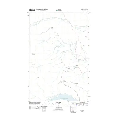
2011 Map of Kiowa
USGS Topo · Published 2011About this map
The small settlement of Kiowa serves as a central point in this high-plains landscape, situated where the South Fork of the Milk River Bridge carries travelers over the water. The terrain is defined by a series of prominent elevations and ridges that separate various drainages, including Cut Bank Ridge and the soaring Mad Wolf Mountain. To the south, the expansive Lower Two Medicine Reservoir sits below Two Medicine Ridge, indicating the significance of water management in this part of Glacier County.
Find a feature on this map
16 named features on this map. Tap any name to fly to it.
Don’t see what you’re looking for? This feature index may not catch every label — zoom into the map to look around manually.
Map Details
Editions of this 2011 Kiowa Map
This is the sole edition of this map. No revisions or reprints were ever made.
Other maps of this area

1901 · Browning
USGS Topo · 1:125,000

1903 · Browning
USGS Topo · 1:125,000

1913 · Marias Pass
USGS Topo · 1:125,000

1960 · Cut Bank
USGS Topo · 1:250,000

1963 · Cut Bank
USGS Topo · 1:250,000

1964 · Cut Bank
USGS Topo · 1:250,000

1968 · Saint Mary
USGS Topo · 1:24,000

1968 · Josephine
USGS Topo · 1:24,000
1968 · Cut Bank Pass
USGS Topo · 1:24,000
1968 · Kiowa
USGS Topo · 1:24,000