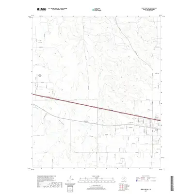
2019 Map of Kirby Lake NE
USGS Topo · Published 2019About this map
Clyde anchors the eastern edge of this landscape, where the residential grid meets the expanding transportation corridors of West Texas. The Interstate system, including I- 20 W and its various access roads, bisects the terrain, illustrating the modern evolution of travel through Callahan County. To the west, the Abilene Executive Airpark marks a transition toward more industrial and aviation-centered land use, contrasting with the sprawling network of county roads like Co RD 103 N and Co RD 258 that serve the outlying ranch lands.
Find a feature on this map
81 named features on this map. Tap any name to fly to it.
Don’t see what you’re looking for? This feature index may not catch every label — zoom into the map to look around manually.
Map Details
Editions of this 2019 Kirby Lake NE Map
This is the sole edition of this map. No revisions or reprints were ever made.
Other maps of this area

1890 · Abilene
USGS Topo · 1:125,000

1891 · Anson
USGS Topo · 1:125,000

1892 · Abilene
USGS Topo · 1:125,000

1892 · Albany
USGS Topo · 1:125,000

1893 · Albany
USGS Topo · 1:125,000

1893 · Anson
USGS Topo · 1:125,000

1931 · Baird
USGS Topo · 1:125,000

1932 · Baird
USGS Topo · 1:125,000

1954 · Abilene
USGS Topo · 1:250,000

1957 · Kirby Lake
USGS Topo · 1:62,500