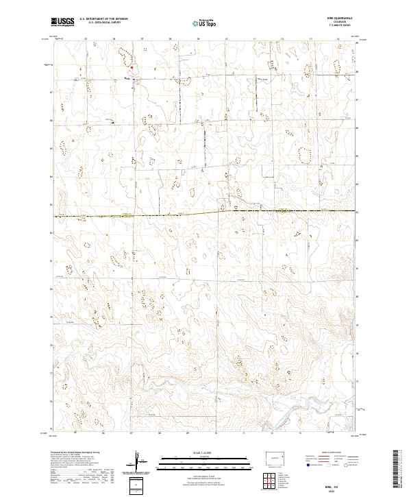
2022 Map of Kirk
USGS Topo · Published 2022About this map
Kirk serves as the primary settlement hub on this High Plains landscape, situated near the northern boundary of a grid of county roads. The area is defined by its agricultural layout, where the Kirk Cem remains a central point for local genealogy and history. The terrain transitions from the upland plains in the north toward the drainage systems of the S Fork Republican River and Hell Cr in the south. This transition from flat farmland to the more complex topography of the river basin is a hallmark of the region, where seasonal waterways like Spring Cr carve subtle variations into the landscape. Small private airstrips like Idlers Field underscore the logistical realities of modern rural life in eastern Colorado, where wide distances between towns are common.
Find a feature on this map
31 named features on this map. Tap any name to fly to it.
Don’t see what you’re looking for? This feature index may not catch every label — zoom into the map to look around manually.
Map Details
Editions of this 2022 Kirk Map
This is the sole edition of this map. No revisions or reprints were ever made.
Other maps of this area

1954 · Limon
USGS Topo · 1:250,000

1957 · Limon
USGS Topo · 1:250,000

1958 · Limon
USGS Topo · 1:250,000

1968 · Joes
USGS Topo · 1:24,000

1968 · Spring Canyon
USGS Topo · 1:24,000

1968 · Adler Creek
USGS Topo · 1:24,000

1969 · Settlement
USGS Topo · 1:24,000

1969 · Tuttle
USGS Topo · 1:24,000

1969 · Idalia SW
USGS Topo · 1:24,000

1969 · Kirk
USGS Topo · 1:24,000